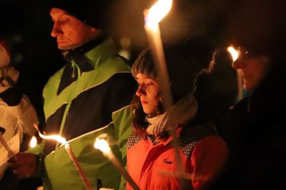
Ski tours in the Hohe Tauern
Bruck is the ideal starting point for dream tours and is ideally suited as a base camp for ski tourers.
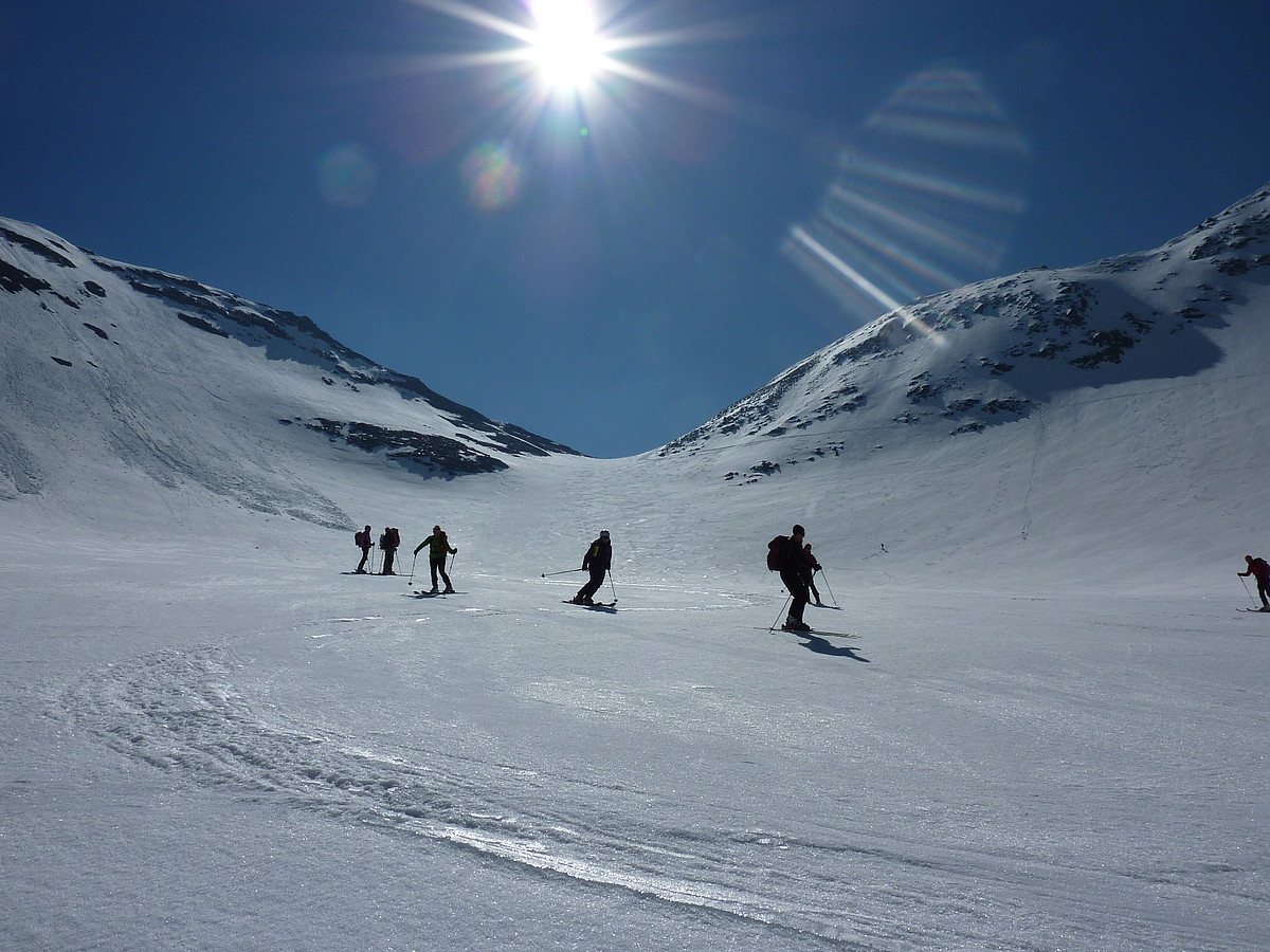
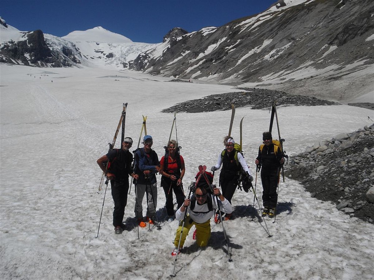
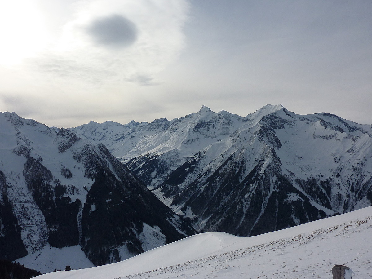
Ski tours in the Glockner area & the Hohe Tauern mountains
In the immediate vicinity of Bruck and Fusch, ski tours to the Ronachkopf, the Schwalbenwand or the Schusterkogel are ideal. But the villages are also ideally located in the middle of the Hohe Tauern, with wonderful ski touring opportunities on the Schwarzkopf, the Hohen Tenn or the Drei Brüder.
Hochkönig & combination tours with cable car ascent
In a few minutes drive you can reach other fantastic touring areas such as the Hochkönig ski touring area or unique combination tours with cable car ascent to the Hocheiser or the Tristkogel.

Hochkönig & combination tours with cable car ascent
In a few minutes drive you can reach other fantastic touring areas such as the Hochkönig ski touring area or unique combination tours with cable car ascent to the Hocheiser or the Tristkogel.
FOR EVERY SKI TOUR IT IS ESSENTIAL TO PAY ATTENTION TO
Weather info: Find out about the weather situation in the touring area before each tour, e.g. on www.wetter.orf.at or www.zamg.at
Avalanche info: Before each tour, find out about the current avalanche situation in the touring area, e.g. at www.lawine.salzburg.at.
In any case, avoid ski tours when there is a warning for avalanche danger.
The use of this tour description is at your own risk. Liability for any accidents and damages is not assumed for any legal reason.
SKI TOURING – SPRING CLASSIC
Ski tour Spielmann, 3.027 m
Altitude difference: 900 Hm
Walking time: 3 hours
Starting point: Glocknerhaus on the Grossglockner Road
Maximum slope: 35 degrees
Touring time: May and June
Highlight: Beautiful, comfortable spring ski tour
Route: From the parking lot over flat and moderately steep slopes to the northeast towards Untere Pfandlscharte (2,663 m). From the Pfandlscharte it rises much more sharply. Over a steep ridge eastward to the ski depot and continue on foot to the summit of the Spielmann.
Descent: Like ascent
Weather info: Inform yourself before each tour about the weather situation in the touring area, e.g. on the
Weather page of the ORF
or the
ZAMG
.
Avalanche info: Before each tour, also inform yourself about the current avalanche situation in the touring area, e.g. on
www.lawine.at
.
In any case, avoid ski tours when there is a warning for avalanche danger.
The use of this tour description is at your own risk. Liability for any accidents and damages is not assumed for any legal reason.
Ski tour Brennkogel, 3.018 m
Three possible routes.
Touring time: May, June (only in stable firn conditions!)
Highlight: Spring classic with view of the Großglockner
Route 1: Elendboden-Brennkogel
Altitude difference: 800 Hm
Walking time: 2 hours
Starting point: Glocknerstraße, Elendboden 200m after the Mittertörl tunnel
Ascent: By car to the Elendboden parking lot. Ascend in a southwesterly direction to the Brennkogelscharte, continue in a westerly direction across the slope and now ascend in a northerly direction to the Scharte and then via the west ridge to the summit.
Descent: Descent as ascent or as an alternative descent south to the Guttal (Großglocknerstraße). However, the same route must be ascended again to the Brennkogelscharte or by car stop or cab back to the Elendboden parking lot.
Route 2: Brennkogel circuit
Altitude difference: 1 .100 Hm
Walking time: 3-4 hours
Starting point: Glocknerstraße, parking lot Fuscher Törl 2
Directions: By car to the parking lot Fuscher Törl 2
Ascent: First a short descent (without skins) southwestward into the enormous basin of the Brennkogelkeese, further flat to the steepening in the basin end, westward steeply on a ridge and southward to the summit. Departure in the southeast direction into the hollow of the Guttalkees. ‘Ascent in a southeasterly direction to a broad ridge and then in a northerly direction always keep slightly to the right until the highest point, short descent to the saddle and then ascent via the west ridge to the summit.
Departure: as for route 1
Route 3: Guttal-Brennkogel
Altitude difference: 1 .100 Hm
Walking time: 3 hours
Starting point: Glocknerstraße, Guttal-Ankehre parking lot
Ascent: At the Ankehrbrücke, head north along an alpine path. In a few minutes at the height of the opposite alpine pasture, diagonally right uphill to the board floors. From here you already have the Brennkogel in front of you. Continue to the saddle left of Brennkogel and then over the west ridge to the summit.
Descent: same as ascent.
Weather info: Inform yourself before each tour about the weather situation in the touring area, e.g. on the
Weather page of the ORF
or the
ZAMG
.
Avalanche info: Before each tour, find out about the current avalanche situation in the touring area, e.g. on
www.lawine.salzburg.at
.
In any case, avoid ski tours when there is a warning for avalanche danger.
The use of this tour description is at your own risk. Liability for any accidents and damages is not assumed for any legal reason.
Ski tour Johannisberg, 3.453 m
Altitude difference: 1 .100 Hm
Walking time: 5,5 hours
Starting point: Franz-Josef-Höhe on the Glockner Road
Maximum slope: Up to 35 degrees, depending on conditions.
Touring time: May and June
Highlight: Glacier tour in the Großglockner area with a view of the Kaprun reservoirs.
Route: From Franz-Josefs-Höhe through the tunnels on the trail Hofmannshütte – Oberwalderhütte. At the end of the path you enter the glacier. Up over the southern Bockkarkees and north past the Oberwalderhütte (2,972 m, winter room). Short descent and now directly towards the Johannisberg. The best way is directly over the east ridge or just left (south) of it to the summit. Many times crevasses, so a rope should be used when there is little snow!
Downhill: If the snow cover is sufficient, the descent is possible directly through the Hufeisenbruch down to the Pasterze (counter ascent of approx. 20 min. at the glacier lift). Keep left on the descent, as the better conditions are usually found here. In the central part should not do without the rope.
Weather info: Inform yourself before each tour about the weather situation in the touring area, e.g. on the Weather page of the ORF or the ZAMG .
Avalanche info: Before each tour, find out about the current avalanche situation in the touring area, e.g. on
www.lawine.at
.
In any case, avoid ski tours when there is a warning for avalanche danger.
The use of this tour description is at your own risk. Liability for any accidents and damages is not assumed for any legal reason.
Ski tour Kloben, 2.938 m
Altitude difference: 1.600 Hm
Walking time: 1,5 hours
Starting point: Glocknerstraße, Fuscher Törl.
Touring time: May, June
Highlight: Spring Classic. Relatively short climb – long descent into Käfertal. Cab transfer Hotel Römerhof in Fusch.
Route: First a short descent southwestward into the huge basin of the Brennkogelkeese, further flat to the steepening in the basin end, westward steeply on a ridge and southward to the summit.
Descent: Descent southwestward to the Spielmannscharte, westward down over the Spielmannkees to the hollow and then northward into the valley. In the lowest third, keep left if possible, because the snow vault above the wild Pfandlbach can collapse!
Weather info: Inform yourself before each tour about the weather situation in the touring area, e.g. on the Weather page of the ORF or the ZAMG .
Avalanche info: Before each tour, find out about the current avalanche situation in the touring area, e.g. on www.lawine.salzburg.at .
In any case, avoid ski tours when there is a warning for avalanche danger.
The use of this tour description is at your own risk. Liability for any accidents and damages is not assumed for any legal reason.
SKI TOURS – HIGH TAUERN
Ski tour Kreuzköpfl, 2.094 m
Altitude difference: 1.280 Hm
Walking time: 3,5 hours
Starting point: 5672 Fusch Glocknerstraße
Maximum slope: 30 degrees
Touring time: December to March
Highlight: Combination with Kühkarlkopf possible.
Route: From Fusch on the road to Sulzbachtal at hairpin bend 5 straight on to the bridge then follow the alpine path on the left to the fork Kammerer Hochalm. From here turn right and follow the alpine path up to the Kammerer Hochalm. Continue across open slopes west to the ridge and then north to the summit. After the rest on the summit, it is worthwhile to climb eastwards over the ridge to the Kühkarlkopf.
Descent: Descent as ascent. If avalanche safety permits, cross the slope 50 m below north of the Kammerer-Hochalm through the forest to the open areas of the Badhausalm to the Sulzbachhochalm and further down to the Sulzbachgrundalm.
Weather info: Inform yourself before each tour about the weather situation in the touring area, e.g. on the Weather page of the ORF or the ZAMG .
Avalanche info: Before each tour, find out about the current avalanche situation in the touring area, e.g. on www.lawine.salzburg.at .
In any case, avoid ski tours when there is a warning for avalanche danger.
The use of this tour description is at your own risk. Liability for any accidents and damages is not assumed for any legal reason.
Ski tour Schwarzkopf, 2.765 m
Altitude difference: 1 .580 Hm
Walking time: 4,5 – 5 hours
Starting point: Bad Fusch (1186 m).
Maximum slope: 35 degrees
Touring time: February – April
Highlight: View of the Zeller Basin and the highest mountain in Austria, the Großglockner.
Route: From Bad Fusch you walk along the forest road to the Embach-Grundalm (1,292m). Past the alpine hut and along the marked summer path through the forest to an altitude of about 1,600m you cross into open terrain. Over initially steep slopes (attention: avalanche danger from the Hochtor on the right) to an alpine hut and further uphill to the right of the ditch to a narrow passage. After the bottleneck in the ascent sense left over the next terrain step and again more in a southerly direction to the Grüne Lacke. The last 300Hm over the steep summit slope directly to the Schwarzkopf.
Descent: Like ascent
Weather info: Inform yourself before each tour about the weather situation in the touring area, e.g. on the Weather page of the ORF or the ZAMG .
Avalanche info: Before each tour, find out about the current avalanche situation in the touring area, e.g. on www.lawine.salzburg.at .
In any case, avoid ski tours when there is a warning for avalanche danger.
The use of this tour description is at your own risk. Liability for any accidents and damages is not assumed for any legal reason.
We recommend hiring a mountain guide for this tour.
Ski tour Hoher Tenn, 3.368 m
Altitude difference: 2.510 Hm
Walking time: 5 hours to the ski depot on the Zwingkopf, 6 hours to the summit.
Starting point: 5672 Fusch Glocknerstraße.
Maximum slope: 35 degrees
Touring time: February to May
Highlight: Challenge for tourers with strong physical condition.
Route: From the parking lot via the forest road to the Schmalzgruben-Hochalm. Climb through the Schmalzgrubenkar to just below the Zwingkopf (ski depot). From here on, crampons are usually necessary. Keeping right over the steep flank to the summit of Zwingkopf. Then over the ridge with climbing difficulties I-II to the Schneespitze and to the Hoher Tenn.
Descent: Same as ascent. In the lower part, a hairpin bend is skipped on the forest road and descended in a direct line to the Grundalm.
Weather info: Inform yourself before each tour about the weather situation in the touring area, e.g. on the Weather page of the ORF or the ZAMG .
Avalanche info: Before each tour, find out about the current avalanche situation in the touring area, e.g. on www.lawine.salzburg.at .
In any case, avoid ski tours when there is a warning for avalanche danger.
The use of this tour description is at your own risk. Liability for any accidents and damages is not assumed for any legal reason.
Ski tour Imbachhorn, 2.470 m
Altitude difference: 1.700 Hm
Walking time: about 4,5 hours
Starting point: 5672 Fusch, Judendorf, Hotel Ponyhof
Maximum slope: 35 degrees
Touring time: whole winter
Highlight: View of the Zeller See and Hoher Tenn from the summit
Route: From Judendorf ascend via a path or directly to the Judendorfalm (1,367m). Continue over flat slopes until there is an opportunity to turn left through a sparse forest below the Rosskopf (2,152m). The Rosskopf is crossed to the north just below the summit. Then continue across open areas to the Bäckenanderlscharte. Short descent from the saddle and traverse to the west below the steep summit slope of the Imbachhorn to the south ridge. Continue north to the summit.
Descent: Like ascent
Weather info: Inform yourself before each tour about the weather situation in the touring area, e.g. on the Weather page of the ORF or the ZAMG .
Avalanche info: Before each tour, find out about the current avalanche situation in the touring area, e.g. on www.lawine.salzburg.at .
In any case, avoid ski tours when there is a warning for avalanche danger.
The use of this tour description is at your own risk. Liability for any accidents and damages is not assumed for any legal reason.
Ski Tour Three Brothers Schafelkopf, 2.266 m
Altitude difference: 1.240 Hm
Walking time: about 3 hours
Starting point: 5671 Bruck, Hauser village, Kesselriß farmstead 1,019 m
Maximum slope: 40 degrees
Touring time: whole winter
Highlight: View from the summit to the Zeller See and Hoher Tenn.
Route: First along the forest road, later shortening through the forest, always following the summer markings to the Erlhofalm. Now the view of the steep part of the tour is free. From the alpine huts through a gentle depression and over the following hill briefly through sparse trees into the increasingly steeper and narrower cirque between Breit- and Schafelkopf. In the upper part left (east) past a rock rib and into the saddle (signpost). In the ascent direction to the right along the ridge to the steep summit climb. Depending on conditions, ski or walk, possibly avoiding the southern flank (very steep!), to the summit.
Descent: same as ascent.
Weather info: Inform yourself before each tour about the weather situation in the touring area, e.g. on the Weather page of the ORF or the ZAMG .
Avalanche info: Before each tour, find out about the current avalanche situation in the touring area, e.g. on www.lawine.salzburg.at .
In any case, avoid ski tours when there is a warning for avalanche danger.
The use of this tour description is at your own risk. Liability for any accidents and damages is not assumed for any legal reason.
SKI TOURS – BRUCK-FUSCH SURROUNDINGS
Ski tour Kreuzköpfl, 2.094 m
Altitude difference: 1.280 Hm
Walking time: 3,5 hours
Starting point: 5672 Fusch Glocknerstraße
Maximum slope: 30 degrees
Touring time: December to March
Highlight: Combination with Kühkarlkopf possible.
Route: From Fusch on the road to Sulzbachtal at hairpin bend 5 straight on to the bridge then follow the alpine path on the left to the fork Kammerer Hochalm. From here turn right and follow the alpine path up to the Kammerer Hochalm. Continue across open slopes west to the ridge and then north to the summit. After the rest on the summit, it is worthwhile to climb eastwards over the ridge to the Kühkarlkopf.
Descent: Descent as ascent. If avalanche safety permits, cross the slope 50 m below north of the Kammerer-Hochalm through the forest to the open areas of the Badhausalm to the Sulzbachhochalm and further down to the Sulzbachgrundalm.
Weather info: Inform yourself before each tour about the weather situation in the touring area, e.g. on the Weather page of the ORF or the ZAMG .
Avalanche info: Before each tour, find out about the current avalanche situation in the touring area, e.g. on www.lawine.salzburg.at .
In any case, avoid ski tours when there is a warning for avalanche danger.
The use of this tour description is at your own risk. Liability for any accidents and damages is not assumed for any legal reason.
Ski tour Schwarzkopf, 2.765 m
Altitude difference: 1 .580 Hm
Walking time: 4,5 – 5 hours
Starting point: Bad Fusch (1186 m).
Maximum slope: 35 degrees
Touring time: February – April
Highlight: View of the Zeller Basin and the highest mountain in Austria, the Großglockner.
Route: From Bad Fusch you walk along the forest road to the Embach-Grundalm (1,292m). Past the alpine hut and along the marked summer path through the forest to an altitude of about 1,600m you cross into open terrain. Over initially steep slopes (attention: avalanche danger from the Hochtor on the right) to an alpine hut and further uphill to the right of the ditch to a narrow passage. After the bottleneck in the ascent sense left over the next terrain step and again more in a southerly direction to the Grüne Lacke. The last 300Hm over the steep summit slope directly to the Schwarzkopf.
Descent: Like ascent
Weather info: Inform yourself before each tour about the weather situation in the touring area, e.g. on the Weather page of the ORF or the ZAMG .
Avalanche info: Before each tour, find out about the current avalanche situation in the touring area, e.g. on www.lawine.salzburg.at .
In any case, avoid ski tours when there is a warning for avalanche danger.
The use of this tour description is at your own risk. Liability for any accidents and damages is not assumed for any legal reason.
We recommend hiring a mountain guide for this tour.
Ski tour Hoher Tenn, 3.368 m
Altitude difference: 2.510 Hm
Walking time: 5 hours to the ski depot on the Zwingkopf, 6 hours to the summit.
Starting point: 5672 Fusch Glocknerstraße.
Maximum slope: 35 degrees
Touring time: February to May
Highlight: Challenge for tourers with strong physical condition.
Route: From the parking lot via the forest road to the Schmalzgruben-Hochalm. Climb through the Schmalzgrubenkar to just below the Zwingkopf (ski depot). From here on, crampons are usually necessary. Keeping right over the steep flank to the summit of Zwingkopf. Then over the ridge with climbing difficulties I-II to the Schneespitze and to the Hoher Tenn.
Descent: Same as ascent. In the lower part, a hairpin bend is skipped on the forest road and descended in a direct line to the Grundalm.
Weather info: Inform yourself before each tour about the weather situation in the touring area, e.g. on the Weather page of the ORF or the ZAMG .
Avalanche info: Before each tour, find out about the current avalanche situation in the touring area, e.g. on www.lawine.salzburg.at .
In any case, avoid ski tours when there is a warning for avalanche danger.
The use of this tour description is at your own risk. Liability for any accidents and damages is not assumed for any legal reason.
Ski tour Imbachhorn, 2.470 m
Altitude difference: 1.700 Hm
Walking time: about 4,5 hours
Starting point: 5672 Fusch, Judendorf, Hotel Ponyhof
Maximum slope: 35 degrees
Touring time: whole winter
Highlight: View of the Zeller See and Hoher Tenn from the summit
Route: From Judendorf ascend via a path or directly to the Judendorfalm (1,367m). Continue over flat slopes until there is an opportunity to turn left through a sparse forest below the Rosskopf (2,152m). The Rosskopf is crossed to the north just below the summit. Then continue across open areas to the Bäckenanderlscharte. Short descent from the saddle and traverse to the west below the steep summit slope of the Imbachhorn to the south ridge. Continue north to the summit.
Descent: Like ascent
Weather info: Inform yourself before each tour about the weather situation in the touring area, e.g. on the Weather page of the ORF or the ZAMG .
Avalanche info: Before each tour, find out about the current avalanche situation in the touring area, e.g. on www.lawine.salzburg.at .
In any case, avoid ski tours when there is a warning for avalanche danger.
The use of this tour description is at your own risk. Liability for any accidents and damages is not assumed for any legal reason.
Ski Tour Three Brothers Schafelkopf, 2.266 m
Altitude difference: 1.240 Hm
Walking time: about 3 hours
Starting point: 5671 Bruck, Hauser village, Kesselriß farmstead 1,019 m
Maximum slope: 40 degrees
Touring time: whole winter
Highlight: View from the summit to the Zeller See and Hoher Tenn.
Route: First along the forest road, later shortening through the forest, always following the summer markings to the Erlhofalm. Now the view of the steep part of the tour is free. From the alpine huts through a gentle depression and over the following hill briefly through sparse trees into the increasingly steeper and narrower cirque between Breit- and Schafelkopf. In the upper part left (east) past a rock rib and into the saddle (signpost). In the ascent direction to the right along the ridge to the steep summit climb. Depending on conditions, ski or walk, possibly avoiding the southern flank (very steep!), to the summit.
Descent: same as ascent.
Weather info: Inform yourself before each tour about the weather situation in the touring area, e.g. on the Weather page of the ORF or the ZAMG .
Avalanche info: Before each tour, find out about the current avalanche situation in the touring area, e.g. on www.lawine.salzburg.at .
In any case, avoid ski tours when there is a warning for avalanche danger.
The use of this tour description is at your own risk. Liability for any accidents and damages is not assumed for any legal reason.