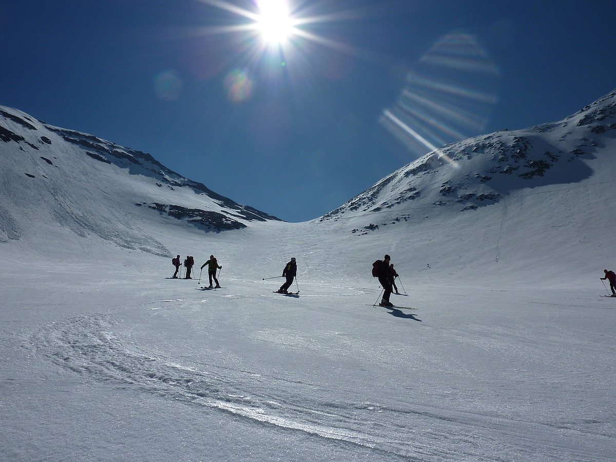
Bruck and the neighboring town of Fusch are a true paradise for everyone on 2 wheels. Mountain bikers, road bikers and also quite normal bikers will find countless possibilities here in all degrees of difficulty.
The well-known Tauern Cycle Path also leads through our village.
Countless mountain bike routes start from Bruck; ascents on forest roads lead to high-altitude alpine pastures and summit huts. You will enjoy the stunning panoramic view of the surrounding 3,000-meter peaks. Adventurers and adrenaline junkies get their money’s worth on the steep downhill tracks (often only half a meter wide).
Families, on the other hand, love the bike paths in the wide Zell basin and around the Zellersee or to Kaprun.
The ultimate challenge for cyclists is to conquer the highest mountain of Austria – the Grossglockner.
The racing and training tracks and extensive tours lead through untouched nature.
Ferleiten is not only a popular family biking area with comfortable mountain bike trails.
Next to the zoo you can find adorable viewpoints and appealing places for a romantic picnic.
With the bike on the Grossglockner
Route 1: Grossglockner High Alpine Road to Edelweiss Peak
1,758 vertical meters
21.9 kilometer
8.0% average slope
14% maximum slope
Requirement:
7.2 km Fusch to the cash point: 4.6% gradient – not very demanding
4.8 km to Piffkar: 9.9% gradient – extremely demanding
2.3 km to Hochmais: 10% slope – very demanding
2.6 km to Hexenküche: 8% slope – demanding
0.8 km to Edelweißwand: 12% slope – very demanding
1.9 km to Gasthof Fuschertörl: 8.1% incline – demanding
2.3 km to Edelweißspitze: 7.7% incline/max. 14% – very demanding
Special feature:
10.1 km: Embach chapel; beginning of the mountain route
14.5 km: Cash point/Ferleiten; parking possibility; game park Ferleiten
19.3 km: Piffkar; panoramic path & gallery; photo site; parking; kiosk
21.6 km: Jochmais; display boards (natural history information), impressive view
23.5 km Witch’s Kitchen; landslide area
25.0 km: Edelweißwand; remains of the Roman road
26.0 km: Obernaßfeld; Alpine Nature Museum, botan. Educational trail, multimedia show, kiosk
26.9 km: Fuschertörl I; Fuschertörl inn, photo location-view of the Großglockner
28.7 km: Edelweißspitze; Edelweißhütte inn, kiosk, highest point on the road, excellent view of more than 30 three-thousand-meter peaks; national park information point.
Overall impression:
Everyone who masters this route is a “GLOCKNER KING
Route 2: Grossglockner High Alpine Road to Fuschertörl II
1,615 vertical meters
20.1 kilometer
8.1% average slope
12% maximum slope
Requirement:
7.2 km Fusch to tollbooth: 4.6% incline – not very demanding
4.8 km to Piffkar: 9.9% gradient – extremely demanding
2.3 km to Hochmais: 10% slope – very demanding
2.6 km to Hexenküche: 8% slope – demanding
0.8 km to Edelweißwand: 12% slope – very demanding
1.9 km to Gasthof Fuschertörl: 8.1% incline – demanding
0.5 km to Fuschertörl: 6.8% incline
Special feature:
10.1 km: Embach chapel; beginning of the mountain route
14.5 km: Tollbooth/Ferleiten; parking possibility; game park Ferleiten
19.3 km: Piffkar; panoramic path & gallery; photo site; kiosk; parking possibility
21.6 km: Jochmais; information boards, impressive view
23.5 km: Witch’s kitchen; landslide area
25.0 km: Edelweißwand; remains of the Roman road
26.0 km: Obernaßfeld; Alpine Nature Museum, botan. Educational trail, multimedia show, kiosk
26.9 km: Fuschertörl I; Gasthaus Fuschertörl, photo location_view of the Grossglockner
27.4 km: Fuschertörl II, kiosk, highlight of the Tour of Austria: royal stage
Overall impression:
Everyone who masters this route is a “GLOCKNER KING
Route 3: Extension Fuschertörl to Franz Josefs Höhe
Same as route 2: Fusch (822m) to Fuschertörl (2,428m): 1,615 vertical meters, 20.1 kilometers
Continue to Franz Josefs Höhe (2.131m) + 13,4 km
Route 4: Extension from Fuschertörl to Döllach
Fusch – Ferleiten – Fuschertörl (timing) – Döllach* – Fuschertörl – Ferleiten
Fusch (811m) to Döllach (1.013m): 51 km
Highest elevations: Fuschertörl 2,428 m, Hochtor 2,503 m
* from Döllach: Continue to Lienz – Matrei – Felbertauern – Mittersill**: 103 km
** Mittersill – Zell am See – Fusch: 34 km
Mountain bike tours
Schnableralm
602 meters of altitude; 8.7 kilometers
6.9% average slope
Directions:
From the center of Fusch along the Glocknerstraße in the direction of Bruck – entry on the left side.
Requirement:
From very easy to demanding.
Slope:
From 5.3% to 17
Overall impression:
easy to manage for experienced mountain bikers
Special features:
managed Judendorfalm
Bike book for entry on the Schnableralm
Brucker Berg circuit
900 meters of altitude; 25 kilometers; gradient 13 kilometers
Directions:
from the town center along the Glocknerstraße in the direction of Bruck – entrance on the left side in the direction of Judendorf
Requirement:
demanding
Special features:
beautiful view, managed Judendorfalm
Embachhochalm
800 meters of altitude; 8.2 kilometers
9.8% average slope
Directions:
Village center Fusch, entrance behind the Apart-Pension Oberreiter
Requirement:
somewhat demanding to very demanding
Overall impression:
Ideal as a sprint route to Bad Fusch – from Bad Fusch for experienced bikers
Special features:
former high altitude health resort “Bad Fusch
beautiful view into the Fusch valley and Zell basin with the Steinernem Meer in the background typical wonderful alpine flora
Kammerer Grundalm
8.9% average slope
Directions:
From the center of Fusch along the Glocknerstraße in the direction of Bruck – entrance on the right side.
Requirement:
from very easy to very demanding
Slope:
from 0.5% to 12
Overall impression:
very demanding for experienced mountain bikers
Special features:
beautiful view
remote route
farmed alpine pastures
Ponyhofalm
A managed alpine pasture that offers small delicacies from our region.
Ideally suited to take a break and fortify yourself.
About the track itself:
* 1.400 meters altitude
* Length about 4.5 kilometers
* 12% average slope
* very demanding
* Walking time about 2 hours
Trauneralm
709 meters of altitude; 13.9 kilometers
5.1% average slope
Directions:
from the center of Fusch along the Glocknerstraße in the direction of the Großglockner – directly at the Ferleiten toll station.
Requirement:
very easy to demanding
Slope:
flat (edeal for children) up to 10.4
Overall impression:
Scenically one of the most beautiful bike trails, also manageable for inexperienced mountain bikers.
Special features:
Variety of alpine flora – orchids in Rotmoos impressive view of 15 three-thousand-meter peaks in the valley end managed Trauneralm.
Kohlschnait
143 meters in altitude, approx. 4 kilometers
12% maximum slope
Routing:
Bruck town center – on the marked Tauern Cycle Path to Niederhof – right up to the Kohlschnait snack station (900 m) – continue up to the fork and down to the right – via Pichldorf back to Bruck.
St. Georgen – Palfen
310 meters in altitude, about 5 kilometers
11% maximum slope
Routing:
From Bruck to St. Georgen via the main road – up to St. Georgen (770 m) and from there to the Palfen (1 080 m).
Places of interest:
Church St. George
Moosalm
776 meters in altitude, approx. 9 kilometers
14% maximum slope
Routing:
From Bruck take the marked Tauernradweg to Gries – from there turn left past the Grieserwirt into the Brandenauer Graben – at the last fork turn left up to the Moosalm (managed).
Special features:
Open continuously from mid-May to early November. View of the Hohe Tauern.
Erlhof Alm – “Three Brothers
900 meters in altitude, approx. 6.5 kilometers
13% maximum slope
Routing:
Tauernradweg direction Taxenbach, after approx. 3 km turn right uphill according to the signs.
Special features:
Continuation of the hike to the summit of the “Three Brothers”, view to the Zeller Lake and Großglockner.
Bichlalm
670 meters in altitude, approx. 6.7 kilometers
14% maximum slope
Routing:
Branch off Tauernradweg Fusch/Sulzbachtal, forest road to Sulzbachalm, short descent to the stream crossing. After crossing the stream again, climb to the Bichlalm.
Dogstone
1,360 meters in altitude, 17 kilometers
16% maximum slope
Routing:
Center of Bruck – over the Salzach bridge right 1 km along the main road – then left on asphalt to Jageregg (1,150 m) – now on forest roads further to Erlhofplatte (1,373 m) – fork to Thumersbach – ridge path to Ebnerscharte – after fork Tödlingalm summit ascent via narrow path to Hundstein (2,117 m) with managed Statzerhaus! Back via Thumersbach or the big round via Maria Alm.
Special features:
Summit tour with 360° panoramic view of the Hohe Tauern, the Steinerne Meer and Zell am See.
Bike tours
Tour 1 – Small Kitzbühel round
Fusch – Mittersill – Pass Thurn – Kitzbühel – St. Johann – Grießenpass – Saalfelden – Zell am See – Fusch
Fusch (811m) to Zell am See (757m): 128 km + 10 km to Fusch
Highest elevations: Pass Thurn 1.275m, Grießenpass 963m
Tour 2 – Great Dientner Round
Fusch – Taxenbach – St. Johann – Bischofshofen – Mühlbach – Dienten – Saalfelden – Zell am See – Fusch
Fusch (811m) to Zell am See (757m): 108 km + 10 km to Fusch
Highest elevations: Dientner Saddle 1,357 m, Filzensattel 1,290 m
Tour 3 – big Kitzbühel round
Fusch – Mittersill – Gerlos Pass – Aschau – Strass – Wörgl – Kitzbühel – Pass Thurn – Mittersill
Return with the Pinzgau train, transfer or 34 km to Fusch
Fusch (811m) to Mittersill (790m): 177 km
Highest elevations: Gerlos Pass 1,531 m, Pass Thurn 1,275 m
Tour 4 – Fusch-Krimml-Gerlosplatte
Fusch – Mittersill – Krimml with or without Gerlosplatte
return with the narrow-gauge railroad to Zell am See
Fusch (811m) to Krimml (1.067m): 67 km
Highest elevation: Gerlosplatte (1.102m)
Tour 5 – Trip to the Gastein Valley
Fusch – Taxenbach – Gastein Valley – Fusch
Fusch (811m) to Bad Gastein (1.002m) or Böckstein: 57 km
Highest elevation: Böckstein 1.131m
Tour 6 – German round
Fusch – Mittersill – Pass Thurn – Kitzbühel – St. Johann – Pass Strub – Lofer – Steinpass (border) – Schneizlreuth – Berchtesgaden – Bad Dürrnberg- Hallein
Return by train to Bruck (to Fusch 7 km)
Fusch (811m) to Hallein (461m) 157 km
Highest elevations: Pass Thurn 1,275 m, Schneizlreuth 1,569 m
** continue over Pass Lueg – Bischofshofen – St. Johann – Taxenbach – Fusch
Hallein (461m) to Taxenbach (779m): 60 km + to Fusch 17 km
Tour 7 – Tennengebirgs round trip
Fusch – Bischofshofen – Golling – Abtenau – Hüttau – Bischofshofen
Return by train to Bruck (to Fusch 7 km)
Fusch (811m) – round trip Bischofshofen (556m): 129 km
** Continue to Fusch via St. Johann: +53 km
via Dienten: +61 km
via Saalfelden: +69 km
Tour 8 – Loferrunde
Small Lofer round:
Fusch – Saalfelden – St. Johann – Lofer – Saalfelden – Fusch: 135 km
Great Lofer Round:
Fusch – Mittersill – Kitzbühel – St. Johann – Lofer – Saalfelden – Fusch: 146 km