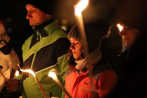
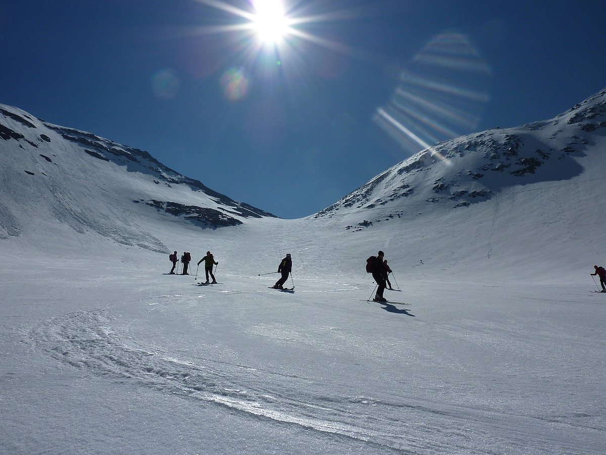
Natur und Idylle
Wandern, wie es Ihnen gefällt …
Spazieren Sie gemütlich um den Zellersee oder zur Burg nach Kaprun.
Oder erkunden Sie den Pinzgau, die Gegend um Bruck-Fusch, Zell am See und Kaprun fernab vom Massentourismus.
Entdecken Sie stille, kristallklare, blaue Bergseen bei einer Wanderung in die Bergwelt… Streifen Sie durch schattige Wälder, schmale Gebirgswege, kleine Wasserfälle und steile Felshänge.
Bruck ladet zu einem vielseitigen Wanderprogramm mit allen Schwierigkeiten ein.
Ob Themenwege für gemütliche Wanderer und Familien oder für erfahrene Alpinisten, Bruck ladet mit einem Wanderprogramm mit allen Schwierigkeiten ein.
HALBTAGESTOUREN BRUCK / ST.GEORGEN / GRIES
Von der Ortsmitte Bruck über die Raiffeisenstraße – am Bahnhof vorbei – Unterführung Westbahn – vor der Stegfeldsiedlung zweigt man links nach Oberhof ab, immer den grünen Markierungstafeln des Tauernradweges folgend.
Über Niederhof – Steggütl – Sagmühle – ca. 1,5 Stunden – zurück eventuell mit dem Postbus.
Über den Fahrweg gelangt man nach St. Georgen, vom Dorfplatz aus Richtung Schloss Heuberg, immer gerade aus Richtung Landau und Winkel zum Palfen – Gehzeit ca. 1 Stunde
Möglichkeiten zum Weiterwandern: zum Hochegg, zur Moosalm und dem Hundstein.
(Vom Hochegg gibt es die Option nach Brandenau und weiters nach Gries abzusteigen)
Talwanderung von Bruck nach St. Georgen und Gries
Von der Ortsmitte Bruck über die Brücke und nach rechts bis zum Güterweg Richtung Bergen – Hundsdorf (Kinderdorf St. Anton) – der Weg fällt leicht ab zur Bundesstraße – nach ca. 100 m links abbiegen über Hauserdorf und Viehhof nach St. Georgen – wenn man der Straße weiter folgt, gelangt man nach etwa 15 Minuten nach Gries – zurück nach Bruck mit dem Postbus, der Bahn oder über die Salzachbrücke – über Niederhof zurück nach Bruck. – ca. 2.5 Stunden.
Große Rundwanderung über das Jageregg
Ortsmitte Bruck – über die Salzachbrücke und nach links – gegenüber der Apotheke hinauf zum Knappenbichl – Gutshof Fischorn – bei der Weggabelung vor Hasling (nicht bewirtschaftet) nach rechts abzweigen und über den Forstweg in den Eßreithgraben und auf das Jageregg – von dort führt ein flacher Waldweg am Hang entlang bis zum Hundsbach – über den Güterweg zurück nach Hundsdorf (Kinderdorf St. Anton) – kurz vor dem Ortsteil kommt man an der Kapelle Maria Stein vorbei – zurück nach Bruck – ca. 2,5 Stunden
Erlhofplatte
Aufstieg ab Apotheke Bruck zum Taxhof (nicht bewirtschaftet) – von dort weiter bergan zum Jageregg – von dort führt der Weg in bequemer Steigung auf den Höhenrücken und weiter über Almböden zur Erlhofplatte (1.541m) – wunderbarer Ausblick auf die Hohen Tauern, das Salzachtal, das Zeller Becken und das Steinerne Meer – daher auch “Kanzel des Pinzgaus” genannt – ca. 2 Stunden.
Rundwanderweg unterhalb vom Jageregg
Aufstieg ab Apotheke Bruck zum Taxhof (nicht bewirtschaftet) – von dort weiter bergan zum Jageregg – herrlicher Ausblick auf die Tauernkette und nach Bruck – nach rechts Richtung Bachseit abbiegen – über Bachseiten den Güterweg abwärts nach Bruck – ca. 1,5 Stunden.
Taxhof
Ortsmitte Bruck- über die Salzachbrücke und nach links – gegenüber der Apotheke hinauf zum Knappenbichl – bis kurz vor den Gutshof Fischhorn – rechts abzweigen und durch den Wald hinauf zum Taxhof – gleicher Weg zurück oder über die Fahrstraße – ca. 1 Stunde.
Wanderung ins Fuschertal
Von der Ortsmitte Bruck aus wandert man die Glocknerstraße entlang, über die Umfahrungsstraße, dann gleich links in die Pichldorfstraße – über die Fuscherache – dann rechts und leicht ansteigend hinauf zum Pichldorf.
Nach den letzten Häusern bei der Gabelung rechts Richtung Fuschertal, später geht es den “Achenweg” entlang bis Fusch – ca. 2 Stunden – zurück können Sie den Postbus nehmen.
Rundweg über Kohlschnait
Von der Ortsmitte Bruck über die Raiffeisenstraße – am Bahnhof vorbei – Unterführung Westbahn – vor der Stegfeldsiedlung zweigt man links nach Oberhof ab, immer den grünen Markierungstafeln des Tauernradweges folgend bis Niederhof. Von dort über den Rodelbahnweg hinauf zur Jausenstation Kohlschnait, weiter zur Gabelung, (links zu den Drei Brüdern) rechts wieder hinab ins Pichldorf und zurück zur Ortsmitte.
Entlang der Salzach nach Kaprun
Von der Ortsmitte Bruck durch die Kaprunerstraße – unter der Bahnunterführung rechts weiter bis zur Salzachbrücke – davor links in die Neuwiesstraße abbiegen – man hält sich immer am Salzachufer, bis man nach 3 km auf der Höhe vom Gasthof “Zur Salzachbrücke” auf den Spazierweg nach Kaprun trifft – ca. 2 Stunden.
Brucker Berg
Von der Ortsmitte Bruck wandert man die Glocknerstraße Richtung Fusch bis zum Kalchangergut, nach rechts abzweigend folgt man dem Güterweg auf den Brucker Berg bis zur Waldgrenze – zahlreiche Bänke laden zur Rast ein – besonders schöner Blick auf den Ort, Schloss Fischhorn, das Zeller Becken, in den Unter- und Oberpinzgau und nicht zuletzt auf das Steinerne Meer – ca. 2 Stunden
Ameisenweg Moosalm
Ein erlebnisreicher Spaziergang im Almgebiet der Moosalm in Gries- für Familien und Natur-Interessierte.
Genieße die Natur, den traumhaften Ausblick auf die 3000er Gipfel der Hohen Tauern sowie die ausgezeichnete Küche auf der Moosalm-Hütte.
WANDERUNGEN FUSCH
Hirzbachwasserfälle – Nepomukweg
Lohnender Spaziergang in nächster Umgebung, mit schönem Ausblick auf das Dorf. Im Ortszentrum Fusch rechts abzweigen, der Straße ins obere Dorf folgen, vorbei am Erlebnis Schausägewerk Mühlauersäge und weiter über die Brücke. Rechts abbiegen, danach führt der Weg zum Unteren und weiter zum Oberen Wasserfall.
Schmalzgruben Grundalm (1.364 m)
Wunderschöner Blick ins gegenüberliegende Weiselbachtal. Knapp vor der alten Maut an der Grossglocknerstraße zweigt ein Fahrweg rechts zum Wimmgut ab. Sie können bis zum Betriebsgelände der Großglocknerhochalpenstraße AG mit dem Auto fahren, über den Fuscher Höhenweg oder der Großglocknerstraße entlang marschieren. Ab dem Wimmgut bringt Sie ein Almweg in 1,5 Stunden durch den Hochwald hinauf bis zur Schmalzgruben Grundalm.
Wölflerweg – Ferleiten
Einstieg nach Ferleiten, feste Schuhe unbedingt ratsam.
Start bei der Embachkapelle, alternativ auch schon über den Fuscher Höhenweg ankommen, der nach ca. 500 Metern einmündet. Ab Wölflerbauer führt Sie der Weg stetig bergan durch lichte Erlenbestände Richtung Ferleiten. Auf der anderen Talseite erleben Sie die Betriebsamkeit der Großglockner Hochalpenstraße und erreichen nach ca. 1,5 Stunden Marsch über saftige Weidegründe das Ferleitental. Beim Tauerngasthof nach links über die Brücke zum Wildpark oder geradeaus weiter in das Käfertal, Tauerngasthof, Oberstattalm, Trauneralm.
Bad Fusch, Weichselbachtal – Walchen Grundalm (1.436 m)
Nach der Pension Oberreiter biegt man von der Glocknerstraße in die Bad Fuscher Straße ein und überquert die Brücke. Nach 4 km erreichen Sie den alten Kurort Bad Fusch (1.188 m). Bei der Kirche vorbei folgen Sie dem leicht ansteigenden Almweg. Dieser Weg führt vorbei zu den Heilquellen und in die idyllische Landschaft des Weichselbachtals mit samtigen Almmatten, stillen Wäldern und rauschenden Bächen. Am Talschluss erreichen Sie die Walcher Grundalm, von wo aus Wegkundige zur Weichselbachhöhe – Wetterkreuz (2.218 m) nach Rauris-Wörth (6 Stunden) übergehen können.
Sulzbach Grundalm
Herrliche Flora der Berge (Almrausch- & Heidelbeersträucher)
Die Wanderung beginnt bei der Tourist Info. Hier quert man die Glocknerstraße und folgt dem Weg zwischen den Häusern. Der linke Weg führt Sie vorbei an der Angereralm, dem Sulzbachwasserfall und durch ein Waldstück. Nun bringt Sie der rechte Weg in wenigen Kehren hinauf zur Sulzbach Grundalm. Von hier aus kann man nach 1 Stunde Gehzeit, bei der Sulzbach Hochalm vorbei, die Bergkuppe Guteben (1.781 m) erreichen.
Sulzbachtal – Kammerer Grundalm
Sehr eindrucksvolle Aussicht, Wasserfall
Ausgehend von der Tourist Info quert man die Großglocknerstraße, danach wird die Fuscher Ache gequert und man wendet sich links. Am Hang bergan für ca. 15 Minuten, quert man ein Bachbett und gelangt weiter zur Angereralm. Von hier aus weiter bergwärts für ca. 1 Stunde. Bei der Weggabelung links Richtung Kammereralm, Sulzbach Hochalm, Guteben, rechts weiter Richtung Bichlalm, Sulzbach Grundalm.
Schnablerweg – Vordertalweg
Einige Rückkehr-Variationen, meist ebender sonniger Wiesenweg.
Ausgehend vom Dorfplatz Fusch biegt man kurz vor der Gemeinde rechts ab und folgt dem schön angelegten Spazierweg in Richtung Bruck bzw. zum Schnablerbauer. Auf der linken Seite steht die malerische Schnablermühle. Auch ein altes Holzkruzifix ziert den Weg. Der Zufahrt zum Schnablerbauer bergab folgend, erreicht man wieder die Glocknerstraße und ist in Kürze wieder im Dorf. Falls Sie jedoch noch mehr Lust auf Natur haben, folgen Sie dem Wiesenweg weiter, der Ihnen eine wunderbare Sicht auf Fusch im Süden bietet. Dieser Weg bringt Sie dann sehr bald auf die Großglocknerstraße. Auch hier haben Sie die Möglichkeit sich für den Rückweg entlang der Landestraße zu entschließen.
Als Alternative zum Asphalt weiter Heimkehrrouten:
- Sulzbach-Angereralm oder den Vordertalweg-Fuscherachenweg.
- Sulzbach-Angereralm: Sie überqueren die Großglocknerstraße und die Sulzbachbrücke bringt Sie über die Ache berauf Richtung Angereralm. Hier können Sie den Sonnenuntergang und den Blick auf das Fuscher Tal bei einer Rast genießen. Nun führt Sie der Weg hinab ins Dorfzentrum (hinter Raiffeisenkasse)
- Vordertal-Fuscherachenpromenade: Man folgt dem ursprünglichen Weg weiter in Richtung Judendorf. Beim Vorderjudendorfbauer vorbei erreicht man bald den Güterweg, der nach Außerreith (975 m) führt.
Sulzbach – Guteben
Eindrucksvoller Blick hinunter ins Fuscher Tal und auf die Hohen Tauern.
Bei der Tourist Info die Glocknerstraße queren, vorbei an der Pension Oberreiter.
Der linke Weg nach der Brücke führt Sie zur bewirtschafteten Angereralm, vorbei am Sulzbachwasserfall und durch ein Waldstück.
Weiter geht es in wenigen Kehren hinauf zur Weggabelung vor der Sulzbach Grundalm. Rechts dem Forstweg folgende, vorbei an der Sulzbach Hochalm, erreicht man nach ca. 1 Stunde Gehzeit die Bergkuppe Guteben (1.781m).
Trauneralm
Den Käfertalweg bis zum Talschluss – dort überqueren Sie nun die Ache an der zweiten Weggabelung. Sie gelangen vorbei am Opel Dankmal zu einem Fahrweg, der Sie durch Wälder in einigen Kehren hinauf zur Trauneralm bringt. Diese war früher ein Stützpunkt für Übergänge Pfandlscharte – Großglockner.
Wasserfallweg in Ferleiten
Walcher Hochalm (1.853 m)
Herrlicher Wasserfall (Grundalm), Ausblick auf die Gletscherbrücke – Wasserfall Erlebnisweg. In Ferleiten hinter dem Gasthof Tauernhaus Ferleiten beginnt ein Saumpfad an der linken Seite des Walcherbaches und führt bergan zur Grundalm (Einkehrmöglichkeit) und weiter auf die Hochalm.
DER WASSERFALLWEG IST BEREITS FÜR DEN WINTER GESPERRT!!!
Ferleiten – Käfertal
Familienwandergebiet, prächtiger Talschluss Käfertal mit dem Rotmoostal (Sumpfwiesen mit in Europa einzigartiger Flora) gehört zu den schönsten Landschaften der Hohen Tauern.
Vom Parkplatz Ferleiten (1.145m) geht’s über die Fuscher Ache zum Tauerngasthof (Ende des öffentlichen Verkehrsweges). Von hier führt eine schmale Schotterstraße flach durch die vielseitige Almlandschaft des Käfertals.
Nach einigen Gattern wird der Weg steiniger, schmäler und steigt etwas zum Talschluss hin an. Hier trennt Sie nur mehr ein Stück Wald vom Blick des westlichen Käfertals. Steile Felswände, an denen Wasserfälle in die Tiefe strömen, zieren den Talschluss.
Kleine Waldungen, Weiden und Almhütten begleiten Sie bis zum Rotmoos, welches man nach 1 Stunde 30 Minuten erreicht. (1.428 m)
An verschiedenen Stationen und auf Schautafeln wird den Besuchern die Besonderheiten dieses Tales nahegebracht. Höhepunkt ist der Wasserspielplatz mit Seilfähre und Kneippanlage.
Bad Fusch
Kapelle, alte botanische Naturdenkmäler.
Vier Kilometer leicht bis mittel ansteigende, asphaltierte Straße bis nach Bad Fusch. Gehzeit eine gute Stunde. Auf Basis der Lehre von Pfarrer Kneipp ist hier ein ganzheitlicher Erholungsraum entstanden: Pavillon Augenquelle, Kneippanlage im Kastanienpark mit Sinnesweg im Labyrinth, Aussichts- und Meditationsplattform mit Ruheschaukel, Tret- und Armbecken. Liebliche Wanderwege durch den Hochwald führen hinauf zum Teich, Rückweg über Wolfgangkapelle weiter zur Fürstenquelle mit Herzbrunnen, wo die Quelle aus dem Berg entspringt. Alle Einrichtungen laden zum aktiven Kneipperlebnis ein. Einkehr und Bewirtung am Kiosk.
Schöner Rückweg: Über die Bichlalm mit herrlichem Blick auf das Fuschertal zur Embachkapelle oder ev. über Fuscher Höhenweg an der anderen Talseite zurück nach Fusch.
Panoramaweg
Vor dem Gemeindeamt Fusch rechts abbiegen und dem Wiesenweg folgen bis zum Schnablerbauern.
Hier links halten und hoch bis zum Waldrand, dann über Serpentinen und Treppen, zuletzt durch ein Bachbett zum Güterweg Richtung Ponyhofalm.
Talwärts auf breiter Schotterstraße, bis Sie an der Glocknerstraße wieder auf den Fuscher Achenweg stoßen. Von hier ca. 3,5 km zurück nach Fusch.
Fuscherachenweg, Fuscher Promenade
Ebene Wegführung entlang des Baches, Promenadenweg mit vielen Sitzbänken, beliebig ausdehnbar. Ob Sie nun von der Schnablerwegroute ins Dorfzentrum oder in Richtung Bruck wandern möchten, beides ist empfehlenswert. Gegenüber der Tankstelle in Fusch überqueren Sie die Brücke über die Fuscher Ache und folgen dem Weg entlang der Ache.
Fuscher Höhenweg
Ausgehend vom Ortszentrum Fusch spaziert man zur Hirzbachbrücke im Oberdorf und folgt dem Weg 725 Richtung Gleiwitzerhütte bis zur Abzweigung. Der Pfad links führt erst leicht begab, dann eben die Wiesenhänge querend zur Zufahrtsstraße Wimmgut, auf der man wieder zur Glocknerstraße gelangt.
Abstieg auch in Höhe Bärenwirt möglich, hier dann retour nach Fusch entlang der Glocknerstraße oder über den Römerweg.